
GET DIRECTIONS FROM YOUR HOME TO BRONSON, TX
CLICK ON THE FOLLOWING LINK:
MAPQUEST
DIRECTIONS TO THE 1815
FROM HOUSTON
Go north on highway 59. Go east on highway 180 (in Livingston).
Go north on highway 96 (in Jasper).
Go apx. 30 minutes into Bronson.
Take highway 184 East to Highway 1 or Temple Road (on the left – is a fork). Turn Left.
Follow it to Horn Drive. Turn Left. Take it into Camp on the Right.
Property is to the right and left of Horn Drive.
(Johnny, Land Manager, lives at the fork – brown house)
FROM DALLAS
FASTER WAY
Take 75 South to 175 East
Take to Highway 69 South
Take to State Highway 21 East
Take highway 184 East to Highway 1 or Temple Road (on the left – is a fork). Turn Left.
Follow it to Horn Drive. Turn Left. Take it into Camp on the Right.
Property is to the right and left of Horn Drive.
(Johnny, Land Manager, lives at the fork – brown house)
EASIER WAY
Take 75 South to I-20 East
Take to Highway 96 south into Bronson
Take highway 184 East to Mcgraw Hill Street, turn Right.
Take highway 184 East to Highway 1 or Temple Road (on the left). Turn Left.
Follow it to Horn Drive. Turn Left. Take it into Camp on the Right.
Property is to the right and left of Horn Drive.
(Johnny, Land Manager, lives at the fork – brown house)
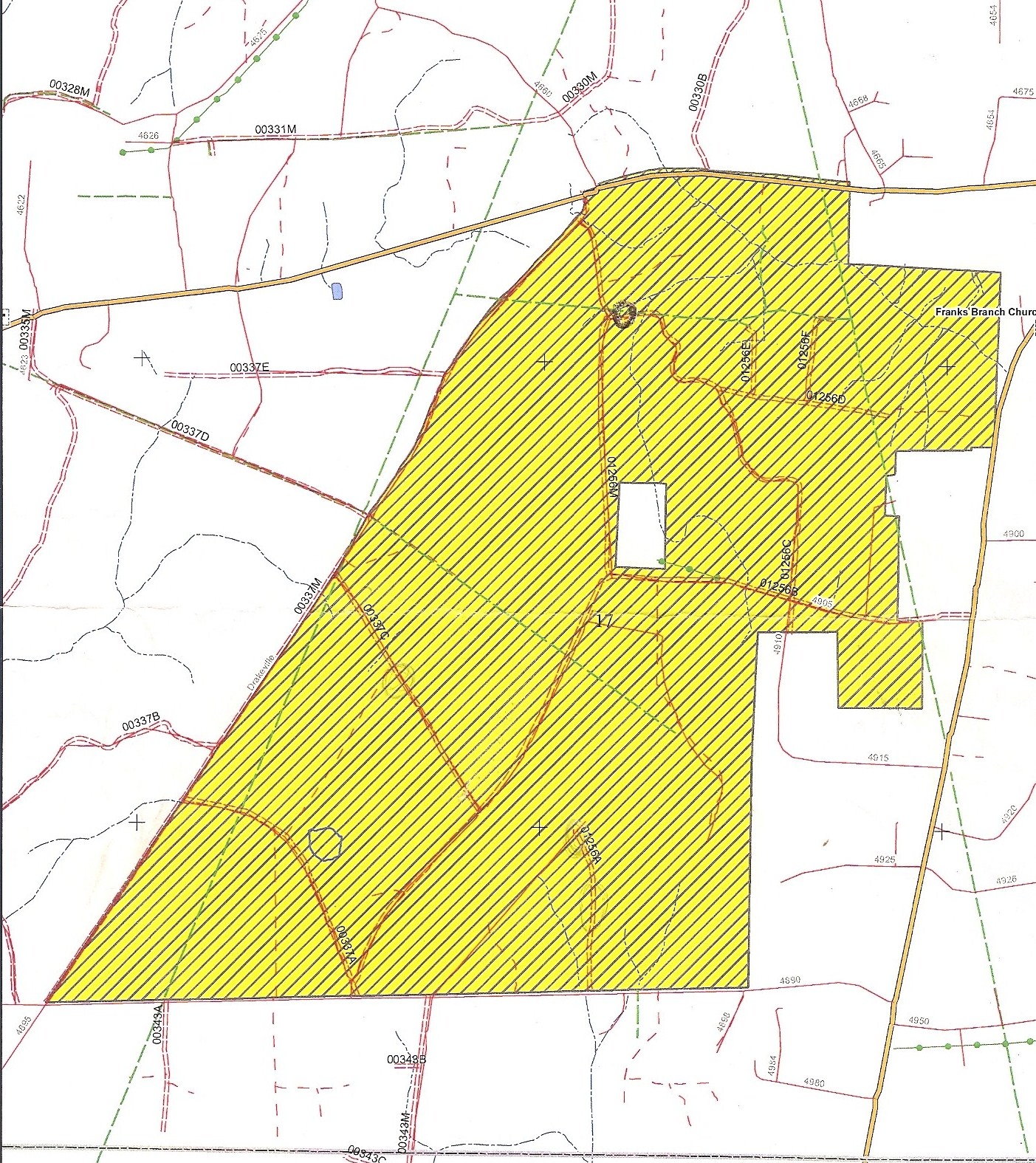
DIRECTIONS TO THE 2100
FROM HOUSTON
Go north on highway 59. Go east on highway 190 (in Livingston).
Go south on highway 92
Pass Highway 1948
Turn right on FM 4905
Property is on the right and left of this road
FROM DALLAS
Take 45 S into Huntsville.
Pick up 190 East and go to Woodville.
Pick up 287/69 South to Warren.
In Warren, pick up Hwy 1943 to 92 South.
(Fred is to the left on 92).
Property boundaries are as follows:
To the North – 1943. To the East – 92 (behind church)
To the West – Drakeville Road
To the South – 4890
Scroll down past map of the 2100 to see Google Map link
DIRECTIONS TO THE 556
Directions: To get to the 556, travel North on Highway 96 to Highway 103. Turn right. Go to 1592 in Rosevine. Turn right. Entrance to the 556 will be on the left before White Road. It is depicted by the double red line on the map below. Go through gate and take road to end. Because this property is small, this camp is very informal. If you want to see the backside of the creeks to the west, you may continue on 1592 and turn left onto White Road which is depicted as the thick red line off of 1592 on the map below. Take it to the opening across from the house at the curve on the left. This is the backside of the BuckDaddys land. See picture under MAPS for this view. For a MAPQUEST map, use this link: MAP QUEST LINK. Please zoom in 3 levels so you can see the route clearly.
If you are coming from the 1815…..Take Highway 1 to Highway 103. Turn right. To go 1592. Turn right. Entrance is on the left before White Road.
![556[1]](https://buckdaddyshuntingclub.com/wp-content/uploads/2016/04/5561.jpg)
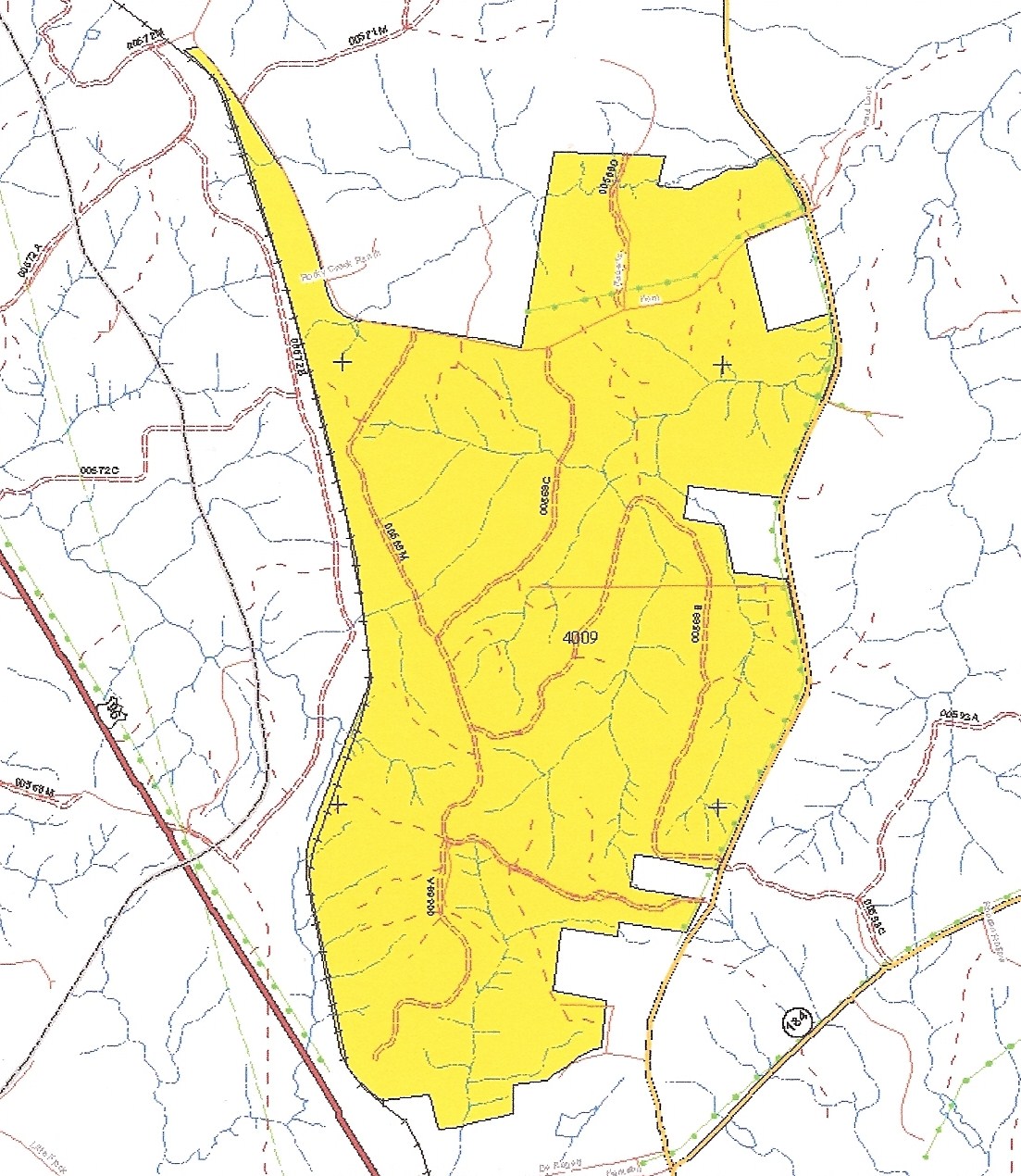
DIRECTIONS TO THE 1815
(in greater detail)
Directions: From Bronson, take Hwy 184 East. Follow road (at fork) to the left at Farm Road 1 (Temple Rd). Go apx. 2.5 miles to Horn Drive. Turn Left. Go apx. 300 yards or 4/10th of a mile to the BuckDaddys’ sign/gate on the right. Turn right into camp. Please note – if you continue on Horn Drive past the camp, you will see 2 gates on the left down Horn Drive. You may enter BuckDaddys property through these gates.
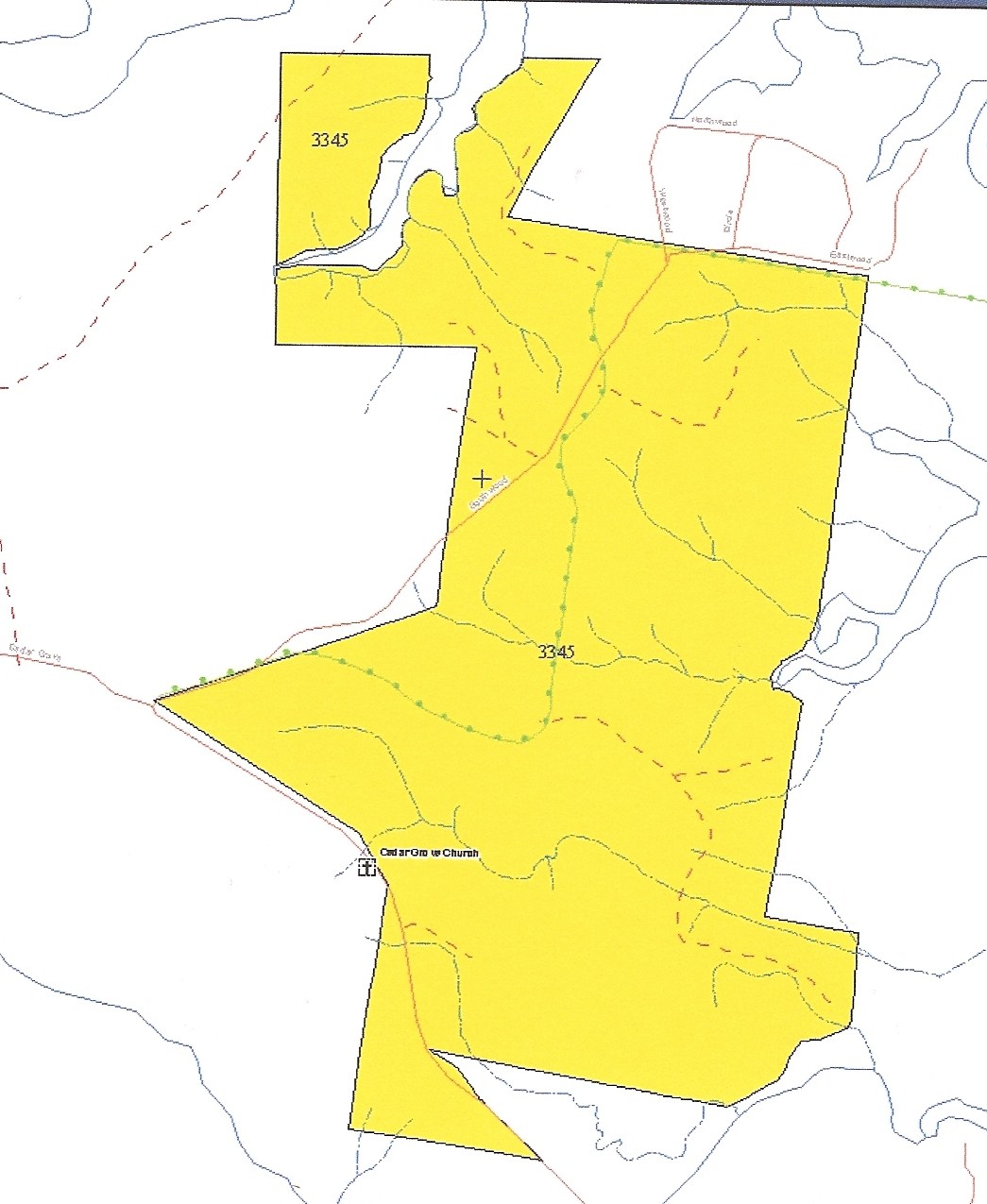
DIRECTIONS TO THE 428
Directions: Take either highway 96 north or Highway 1 north to Highway 103. Turn Right. Go to Highway 21. Turn East towards Milam. Go to Highway 87. Turn left. Go to Telephone Road. Turn right. Go to Cedar Grove Road. Turn right. Go to Southwood Drive. BuckDaddys’ property begins at the point where Cedar Grove meets Southwood Drive (see the point on the left border of the map below). Please view the MapQuest link at http://www.mapquest.com/maps?city=Milam&state=TX&address=%5B100-499%5D+Telephone+Rd&zipcode=75959&country=US&latitude=31.482505&longitude=-93.835625&geocode=BLOCK to compare the map below to the mapquest map. You will get a great understanding of our property in relation to Toledo Bend Lake
DIRECTIONS TO THE 2100
Google Map:
The Google maps url is below. Type in Fred, TX in the white bar when it loads. Zoom out & move it down to south of 1943 & west of 92.
* Acreage is approximate